
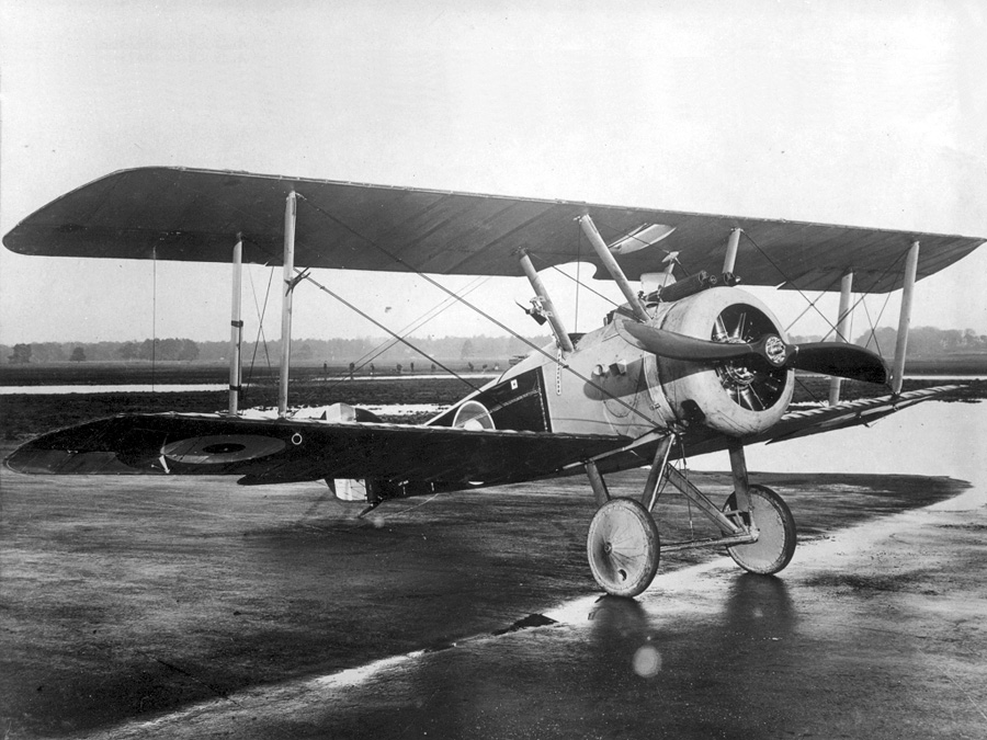
OPENING QUESTION: Recall our conversation of WWI aircraft.... specifically the "Sopwith Camel":
What sort of tools would be available to you waaaaaay back then (when again?) to assist you in navigation....
LEARNING GOAL FOR TODAY: I will be able to demonstrate how early pilots and navigators were able to find their way during today's class.
WORDS O' THE DAY:
- Navigation: ("controlling the movement of a plane from one place to another")
WORK O' THE DAY:
Navigation is essentially the art and science and getting from one place to another...

═══════════════════════════
Let's diverge a bit before we dive into aerospace navigation.
Let's consider the great polynesian navigators from ~1000 years ago.
There were several phases of 'great migrations' around the Pacific Ocean... two of those were (to many folks, myself very much included) absolutely incredibly remarkable: Navigating from Tahiti in the South Pacific ocean across several thousand miles of ocean to Hawaii.
Let's take a look at a map...
How do you suppose they accomplished that?
Back when I was a freshman in high school (1976!), the Hokule'a made its maiden voyage to Tahiti and they did it without modern navigational instruments at all. My understanding is that there were only a very small (less than 5?) people in the whole world who knew how to do that.
That's almost vanished art was re-established and is now being taught and shared around the Pacific
═══════════════════════════
Back to our opening question:
Early aviators back in the 1910's and 1920's had to rely on 'dead reckoning'. What do you suppose that might be?
Basically.... early fliers navigated by sight. That was mostly practical because their range was fairly limited (200 miles or so).
Although it is possible that they *might* carry simple charts or maps with them, why is that very unlikely?
So.... the very first aviators had to be able to see where they were going and to have a good idea how to get there (and return!) before they left.
═══════════════════════════
What about this plane?
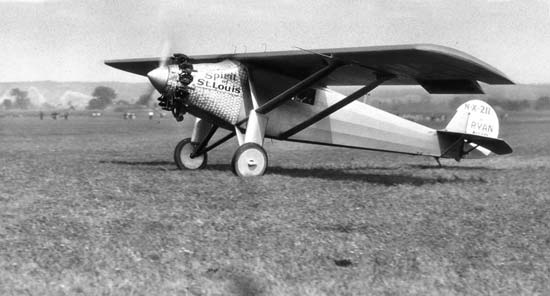
Why was navigation MUCH more important then?
What tools were available to Charles Lindbergh? How far did he fly? How long did it take?
═══════════════════════════
We will continue with WWII aircraft next time--
Now please do a quick google search (hopefully you haven't done that already) and see what sort of tools a WWII bomber navigator would use on a bombing mission.
Imagine you are that WWII bomber navigator once again.... you have a few moments of spare time on your flight... could you possibly have imagined a future where regular ol' folks like you and me, would have a small device that fits into our hand that would accurately provide our location anywhere in the entire country (and in fact most of the world).
Further, would you ever have imagined that you could actually speak to that device and have that device provide point-to-point navigation for you?
Most likely any such thoughts would have been way in the realm of science fiction...
And yet today we do all that with our smart phones!
═══════════════════════════
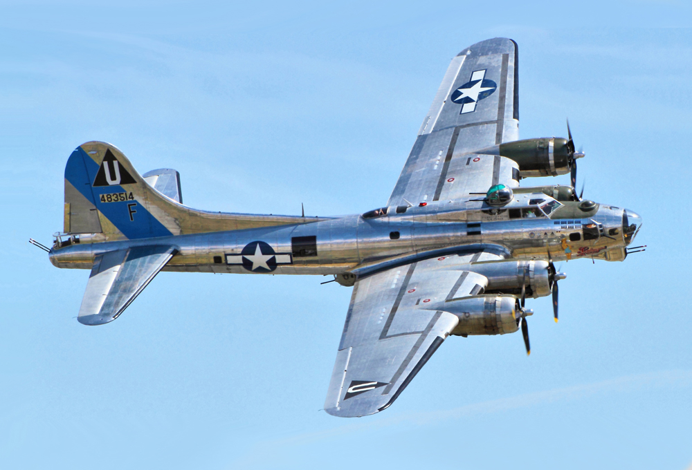
Back to WWII:

Why do you suppose the navigator is dressed so warmly? (The entire crew wore those fleece-lined "bomber jackets" by the way)... here's something I learned while researching that
Take a quick look at THIS page and scroll down to the section about the B-17 "Duties and Responsibilities of THE NAVIGATOR".
There is a bit of jargon there, so please feel free to skip over information that is a bit tedious.
Notice the HUGE emphasis on visual references.
For the most part, the navigator basically steered the plane on a particular course at a particular speed and then checked the planes progress by looking at charts.
It's all basic physics!!! (rate x time = distance!)
For example:
-
The navigator points the plane in one direction (for example due west) usually towards a specific landmark like a town, or a mountain or a large building or group of buildings that is a known distance away
-
The navigator knows the distance to the landmark from his charts
-
He monitors the speed of the plane from instruments on the plane
-
Knowing the speed of the plane and the distance to the landmark, he calculates the time it takes to get to that landmark
-
When that amount of time gets close, he looks out the window, finds out how close his calculations match the actual location of the plane and makes adjustments
Let's try a basic "for instance" using the same steps
1) We take off from our bomber base in England and the Navigator points our B-17 due west
2) There is a small town on the shore of a lake 150 km away due west and we aim for that
3) We carefully monitor the speed of our B-17 and see that our average speed is 300 km/hr
4) Using physics we know that rate x time = distance so that also means that rate/distance = time. In this case, we can tell that the plane SHOULD arrive over that town in 1/2 hour (30 minutes).
5) We continue to look out the window, especially as we get close to 30 minutes. In this example, our calculations are pretty accurate and we arrive above that town just a little later than we calculated, 31 minutes.
6) Now that we know precisely where we are, we aim for another landmark on another course at a different distance and we head for that and repeat the processes!
═══════════════════════════
SUB: If there are table groups of 1 or 2 students, please combine them with other table groups to make groups of 3 or 4. Thanks!
Now take a few minutes to work with your group to post ideas on our jamboard (we haven't used that this year but I'm sure many of us used it last year online) of 5 - 10 things that could cause problems to your navigation on such a flight.
SUB: Please spin the wheel if you have a laptop or/alternately call on a student and have them spin it on THEIR laptop!
Now let's spin the wheel and have a volunteer come up and lead a conversation of those ideas